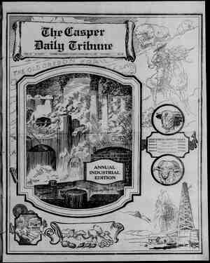
Casper Daily Tribune Newspaper, February 15, 1925, Page 20
You have reached the hourly page view limit. Unlock higher limit to our entire archive!
Subscribers enjoy higher page view limit, downloads, and exclusive features.

y at 4. > « 1 1 « D é PAGE SIX : Che Casper Daily Tribune SUNDAY, FEBRUARY 15, 1925 PROVED OIL AND GAS FIELDS OF STATE REVIEWED ABOWELLS IN | PREMIER FIELD Oil Production Scat- tered Over Wide Area of Siate. e of this being a stri g vigor for the will mean the ¢ than $100,000,- next four 3 diture of, 1 Plans call ¢ east 600 wells a year. Howe vast are the pools now producing in Salt Creek, interest is directed n lower sand: aince the e in the Lakota. sts are now hammer 3 of the stru 1 of the year rest veral ing into and before the should reveal st black off gust ut Salt Creek was discovered. Shallow wells tapped the Shannon sand and produced that form: for years. Fi second Wall Creek sands wi veloped and the extent of the ¢ became astounding. Its area, valu able for oil and gas, is figured to contain 16,000 actes Salt Creek production ts brought to Casper through five pipelines. TEAPOT DOME—Restricted by re- ceivership, navel ofl reserve No. 3 or Teapot Dome, was aot deve during 1924, the object being on! keep wells in working order. field which adjoins Salt Creek was originally placed under the control of the Mammoth Ol] company Harry F. Sinclair interests in Controversy ar over the leg of the lease and the reserve thrown Into receivership per disposition in the co’ First of the wells to make a strike was a sensation, ting a shale pocket and blowing at the cate of 28,000 barrels a day for several days Other wells drilied were ordinary ‘With a total of 62 wells the dome |: now producing an average of more than 2,000 barrels daily, the major part of the output coming from the second Wall Creek sand. The best wells are on the saddle between Tea- pot and Salt Creek. Here and chere oll ts obtained trom shale and the third Wall Creek sand. The potent- jally productive area of the struc ture !s sald by petroleum production experts to be 4,000 acres. A pipeline has been built ¢rom the (eld to Free port, Mo., a distance of 714 miles, where connection is made with a trunk line from ché Midcontinent field to Chicago. The same line takes royalty ofl from Salt Creek to Chi < cago. BIG MUDDY—East of Casper on the Yellowstone highway about 20 miles distant, lying in both Natrona and Converse counties, The 201 wells in the field produce from 4,006 to 4,500 barrels of light ol! daily from the Frontier sand at an average depth of 3,100 feet. Pipeline to Glen rock and to Casper. Discovery wa in 1915, ROCK CREEK—An Ohio Of1 cém pany field near to the Union Pacifi railroad in Albany and Carbon cour tles. First well that brought tn pr duction was drilled in 1918—the are now 67 w Luck played large part in the finding ¢ field, since the test was abandoned as a duster w tapped the pocl. The ou ofl which comes from t! kota and Lakota sands. Pipeline t Taramile and to I BOLTO county, Casper i fair drilling program fo! zt brought sufficient production to war rant the construction of a pipeline to this city, Output 1s black of from | the Sundance and Embar sands. No | oil has yet been run | DALLAS AND DEURBY—The old est field in the state and has beer capsble of producing since 1 located fifteen «miles Lander in Fremont cou from 31 wells of & close to a total of ON is black, comir sand. BYRON OR GARLA west of Greybull, 44 miles, « Park © Discovery teat n 1907. and k from r 1 gas lines to Pow ley. ELK BASIN—In ming in Park cou the state line into dis { de sther southern tana. Produces from 140 wells « lght « 2,000 barrels daily of the Frontier sar G close to 100,000,000 ¢ and is taken from ¢ tion. Pipe Une to Billings, Mont., a distance of 66 miles. Discovered in 1915, FERRIS—-In Carbon county about 25 miles north of Rawlins. Produc: tion of Nght ofl and gas from Mowry shale, Field opened In 1918, now bas eleven wells, Pipo line to Parco. | GRASS CREEK Northwest of Thermopolls, in Hot Springs cov nbout 40 miles. Discovery fost drilled) jn 1914, Tas 256 wells which are cap edie of producing about 4,000 barrels SUBLETTE Q 20 rner Cte nes per day of light ofl from the Fron- Uer sands and four wells pumping ack ofl trom the Embar and Ten- sleep sands. Pipeline to Greybuil. HAMILTON—About twenty miles west of Thermopolis,in Hot Springs count. First favorable test in 1919. Production of 21 wells is black ot] from Embar sand. Pipeline to Greybull. HUDSON—Ten miles east of Lan- der {n Fremon: courty, and one of the oldest fields in the state. Pro- duction from 88 wells ts about 175 barrels of black of] dally from the mbar sand. Pipeline to Rivertan. ANCE 2K—Opened up with a boom tn 1918. During 1934 several arge strikes doubled its 1923 output, maktog its future look excellent. ‘The field ts in Niobrara county about 30 oes north of Lusk. Light of] ts ob- atned in 27 wells trom the Muddy and Cloverly formations. Gas comes from the saroe sands with no market for it at this time. Pipeline to Lusk. LOST SOLDIER—About 40 miles northwest of Rawlins tn Fremont, tarbon and Sweetwater counties Discovered in 1918, Proven area {s ne square mile. Production comes from 50 wells and {s ight of! from Wroniter, Dakota and Lakota sands. Pipeline to Fort Steel on Union Pa- cific rialroad and to Casper, MAHONEY—North of Rawlins in Carbon county, about 88 miles. Open- ed up tn 1919.A gas field with pro- duction from Cloverly formation averaging 20,000,000 cubio feet to the well, Pipeline to Casper supplying refineries with fuel. BRENNING BASIN—An old field of shallow producers in Converse county. There are ten wells niaking close to 30 barrels dally of high FOR SERVICE Quality Goods and Right Prices ie, pene eS. a ae TI ae ae | ca ca | t PRINCIPAL OIL AND GAS FIELDS, REFINING CENTERS AND PIPELINE CARRIERS IN STATE anor WYOMING nhs Meda Ls I PRINCIPAL OIL GAS FIELDS, PIPE LINES AND REFINERIES. EGEND ‘bor iach Piast ney, ordas eis @ County Seat grade light ofl which is refined at a small plant in the field. LITTLE BUFFALO BASIN—Lies northwest of Thermopolis, about 60 miles, in Hot Springs and Park coun: ties. A gas field now capable of put- ung out 000,000 cuble t for which there is no present outlet. The first well was drilled to completion in 1914 BIG SAND DRAW —Twentythree miles southeast of Riverton in Fre mont county, discovered in 1917 Ready from its present wells to pro: duce 35,000,000 cuble feet daily and now furnishing Lander and River- ton with gas. The flow comes from the Frontier sand, PILOT BUTTE about 25 miles northwest of ‘on. There are 27 producing w averaging 900 feet in depth in this field which was discovered in 1916. Output ts around 80 barrels of light oll daily. Pipeline to Riverton. BOONE—Four miles southwest of Powder River in Natrona county. From two deep wells approximate 50,000,000 cuble feet of gas ts com ing daily. Pipeline to Casper. Dis covery test drilled in 1918, NOTCHES—Northwest of Casper abbut 40 miles, !n Natrona county. One well of shallow depth is pro- dueing black oll at the rate of 200 In Fremont ce lis barrels per day from the Tensleep sand. Pipeline to Lox. Discoveved tn 1922. GOLDEN EAGLE—In Hot Springs county about 22 miles northwest of Thermopolis. Two wells in the field having an output of more than 10, 000,000 cubic feet of gas daily from the Mesa Verde formatiou. Discover. ed in 1920. BIG BUFFALO BASIN South Phone 401 Or 1816 WHOLESALE ONLY We Do Not Sell Your Customers THE AUTO EQUIPMENT CO. 130 N. Center St. CASPER east of Lander about 60 miles, in Fre- mont county. Ono well in the field having a capped-in production of 36,- 000,000 cuble feet of gas per day at the shallow depth of 900 feet from the Frontier sand Discovered in 1923. No outlet at present. HIDDEN DOME — Twenty-five n southwest of Greybull, in Washakie county. There are five wells in the field producing 40,000,- 000 cuble feet of gas daily. Pipeline to Greybull. Discovered in 1917. WAKEMAN—In Crook county. | Bight wells at the exceptionally shal low depth of 300 feet | ing at the average rate rels of very high grade ot There is no pipeline from the fi | which old one in the #t RICK SPRINGS — Forty miles northwest of Riverton in Fre- | mont county. Has capped-in produc- tion of black ofl from the Embar sand of about 2,000 to 3,000 barrels daily from 22 wells, MULE CREEK—In Niobrara coun- ty, not far from the South Dakota line, Field opened up in 1919. Has 40 | wells. Output of Ught ofl from La: | | kota rand. Produces intermittently on basis of market demands. Pipeline to Dakoming, 8. D., 14 miles east. OREGON BASIN—Fifteen miles southwest of Cody !n Park county. Discovery of field was in 1912. Has total daily production from the Mor- rison and Cloverly formations cf about 75,000,000 cuble feet. Pipeline to Billings, Mont. OSAGE—A Weston county field producing light ofl from the Muddy sand; about 15 miles northweet of Newcastle. Has 89 wells, Explored and opened up in 1920, Pipeline to loading racks on Burlington. black about 25 miles west of Casper; dis- lin NIO BRARA PINE MOUNTAIN — Twenty-five miles northwest of Casper in Na- trona county. Tested in 1919. Some oll and gas coming from the Embar sand. Still being pros ected. —Twelve miles north MOORCROF™ of Moorcroft in Crook county, Small ight oll production from a few shal- ow sand wells. No pipeline. POISON SPIDER — A gas and oil field In Natrona county vered tn 1918. Potential production s cloge to 6 10 cuble feet of gas jaily from the Sundance ‘sand. Pipe. 8 to Casper from both and ol). ck oil production ts approximate. y 100 barrels daily. WARM SPRI Seven miles Current Assets: county, Tested out in 1917, Produc- Uon of black ofl from the Embar sand at the rate of about 100 barrels daily, Shut in almost continuously for the past two years. Pipe line to Thermepolis. WERTZ— One mile east of the Loat Soldier field in Carbon county. A gas field having a large output from the Cloverly formation. Gas is wet, making much casinghead gasoline. The gas is piped to Cas- per. SOUTH CASPER CREEK—In Na- trona county, 26 miles northwest of Carper. Black oll production of close to 400 barrels daily from the Ten- sleep sand. Pipe line to Casper, Dis- covered in 19238. BLACK. MOUNTAIN — East of Thermopolis, about 40 miles in Hot Springs county. Discovered in 1923. Black ojl from the Tensleep sand. One well doing almost 300 barrels daily. No pipe line outlet. LOX—Near the Burlington rail- road, about 50 miles west of Casper, in Natrona county. A gas field with shut-in production from the Frontier sands. Discovered in 1952. BILLY CREEK—In Johnson coun- ty, 15 miles south of Buffalo, Fairly large potential gas area with pro: ductive sands being tu the Frontier formation. Discovered in 1922. Be- ing tested for oil. BIGHT MILE LAKE—In Carbon county, elght miles south of Raw- lins. A gas field with one well mak- ing 21,000,000 cybie feet daily from the Cloverly formation. Pipeline con- structed to Parco. Discovered in 1923 REXPLAKE—West of Laramie, about 25 miles in Albany county. Two deep wells flowing light ofl at the rate of 50 to 60 barrels daily from the Cloverly formation, constitutes the present production of the field. Discovered in 1923, Will probably be pumping field. Pipeline planned. MEDICINE BOW—A 1923 discov- ery in Carbon county, about 60 miles east of Rawlins. Production cf ght oil coming from Frontier and and tests of structure still proceeding. BAXTER BASIN—A gas field get- ting {ts output from the Frontier «nd Cloverly formations. Location ts just south of Rock Springs in Sweet- water county. Pipeline to be built to Rock Springs. Discovered {n 1923. ENOS CREEK--In Hot Springs county, not far west of Grass Creek. Discovered in 1923, Gas production of 40,000,000 cubic feet. Test contin- ued deeper for oll. Is a worthwhile potential gas field. six miles southwest of Big Piney. Light olf production from a depth of about 1,200 feet. Amount of out- put from one well drilled is not known, TORCHLIGHT — In Big Horn county, ten miles southeast of Grey- bull, Shallow field with a small amount of high grade production. Discovered in 1908. Pipeline to Grey- bull GREYBULL—Located at the edgo of the town of Greybull and one of the earliest discoveries {n the rtate. Has 18 shallow wells producing from Hot Springs the Greybull or Dakota sand. DRY PINEY—In Sublette county, | BELLE SPRINGS — In Carbon county about 20 miles north of Raw: lins. Opened in 1924 as a gas field, the test well bringing in approxi- mately 15,000,000 cubic feet of gas from the Muddy sand. Flow capped: in, ARMINTO—Northwest of Casper in Natrona county about 50 miles. Discovered in 1924. Potential output of gas from one gf the Frontier sands amounts to 5,000,000 cublo feet. Test well will probably be drill- ed deeper for greater production . CIRCLE DOME—Continuation of Maverick Spring field in Fremont county. Discovered in 1923, Has one shallow black o!! well and will prob- ably be developed when plans are made for releasing Maverisk Springs production. Small fields where the production at present is elther inconsequential or entirely shut {n due to distance from transportation facilities, are shown as follows: Southwestern Wyoming. Spring Valley—Light oll. Fossil—Light oil. LaBarge—Light oil. Rawlins Region. G. P, Dome—Light oil. Laramie Basin. Allen Lake—Gas, - Wind River Region, Winkleman—Gas. Central Wyoming. Iron Creek-—Gas and light ofl. Powder River—Gas. Shannon—Light oll. Suya0 £4, ws03s057 Old Woman Creek — Some black ofl. Big Horn Basin. Kirby Creek—Light oll, Murphy—Gas. Crystal Creek—Black oll. Spence—Black oil. Lamb—Light oil. Shoshone River Region. Pole Cat—Gas. THE TEXAS co. CONSOLIDATED BALANCE SHEET AS OF DECEMBER 31, 1923 ASSETS Real Estate, Leaseholds, Oil and Gas Wells and Equipment, \ Pipe Lines, Tankage, Refineries, Terminals, Ships, Cars, Distributing Stations and Other Facilities________ Corporate Securities-_______ ORSHY ae ees Se oe ee Neen eee se R141870/010,04 Accounts and Notes Receivable-________-_____--_--_ 18,183,861.77 Merchandise, Crude and Refined Oils.._-____-_________ DPHTeHOuss RUDDNGS auc peewee eer Deferred Charges to Operations._..-__.-.----.-...-... 84,279,976.83 8,483,100.72 CAPITAL AND LIABILITIES CanitaleStogicn 2 a0 Seta oe ee eae gered ae AE ey Set [ay ape) {iT Paths Aan Neti y ae eel rp os NO be ails pe &. Reserves: Depreciation oi. -seaosnoc~Cados Amortization of Facilities _-_-___ Deferred Purchase Obligations-____.__..-__.-_--._. Current Liabilities: , Accounts and Notes Payable,__-._-__________.___.__ $86,277,870.80 Miscellaneous Phone 315 By ~------~------~--$74,082,567,.38 2,552,541.84 1,818,987.68 THE TEXAS COMPANY Texaco Petroleum Products SALES DEPT. CASPER, WYO, J. A. HOWSER, Agent MINES BUREAU - G0-OPERATES (Continued from Page Five.) been brought to the surface. The work necessitates a close contact with the operator who !s doing the actual development work, inasmuch without his co-operation the best and most economical results could not be obtained. ’ At the present time the govern- ment is deriving royalties from 12 fields in the state, and is supervising the drilling of approximately 275 new wells on 102 structures in both Proven and wildcat areas on govern. ment and Indian lands within the state. Royalty Values Computed cat UY ios, to compute the royalty bonds and One of the duties of the burea: the royalty value of all government oll and te render periodical state ments to the general land office at Washington which, in turn, collects the moneys due. This accounting for the Rocky Mountain district is in charge of F. M. Blehr who {s one of the members of the Casper office personnel, In the second paragraph of this article it was stated that the work of the petroleum division in the stat® {s divided into two general divisions. The first has been briet- d above. The second {s the research division. During the year 1924, in co-operation with the University of Wyoming, the bureau of mines established a. research office at Laramie, the work of which {s supervised by Dr. D. B Dow. Associated with him in this connection are five research engin- eers and chemists. This office, which {s under the ‘direct super. vision of H, H. Hill, supervisor of oil and gas research work for the bureau, is closely associated with the bureau of mines experimental station at Bartlesville, Okla., and {s at this time engaged in research work having to do with the paraf- fine problem in connection with ol! production, the absorption of gas in oll, and with water analysis and many other problems. It {is also making a detailed study of the Lance Creek ofl field, located in Niobrara county, with the object of solving the water problems confront: ing the operators in that field. The” object in the establishment of ¢tilis new office was primarily to work with the operators of the Rocky Mountain district in the solution of the many problems which have aris- en {n connection w!th the production of of] and gas in the district. Although the leasing and research divisions are separate organizations within the bureau, the relationships existing between them are c'osely co-ordinated, each working with the other with the object of assisting th: operator with his development and conseryation problema on both pri- ately and government owned lands. ” $242,442,271.67 1,608,287.26 125,267,449.86 1,835,085,.81 $870,653,044,10 —F—— $164,450,000.00 88,477,484.72 76,685,109,.22 8,498,642.18 87,596,857.98 $370,653,044.10 —— AG