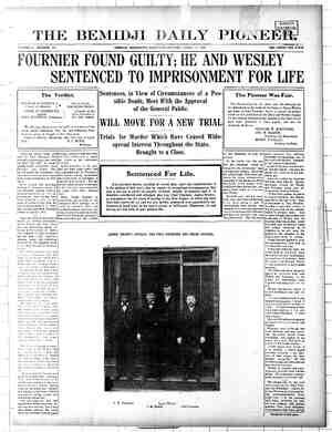
Grand Rapids Herald-Review Newspaper, April 13, 1907, Page 7
You have reached the hourly page view limit. Unlock higher limit to our entire archive!
Subscribers enjoy higher page view limit, downloads, and exclusive features.
=e * Joseph McHardy, UNITED STATES DISTRICT OF MINNESOTA, FIFTH DIVISION. e ‘thence north 12. de- utes west S10 fapk: more ov lesa: of said tract; thence east on : hie United | point of beginnings The suse line of suid lots In the m f thi icatic f the Un int of east line of s: - es ieee! ering sai demoation: of | 1s used as & meridian in this description. certain lands in Itasca county, in’ the Patehene $e sap eryeceun, +» 26.6 acres State of Minnesota, at, adjacent to. and “ i > yicini Pokegama and Winni-} All of Lot 3, Section 14. Township 55 North, bigeshich nity of Bol on tbe Mississippi | Range 26 West of the 4th principal somes bees river, | All of Lot 4, Section 14, Township 55 North, Range 26 West of the 4th principal meridian sees sbeesearte ce pees + 22.84 acres To Hattie C, Lew! 7. B. Waike Daniel Vollick, Emil A. Schrepel, J. F. Whipps. Frank Smith. Owen Skelly and John Skelly, as Skelly Bros., a co-partnership, That portion of Lot 5. Section 14. Township North. Range 26 West of the 4th principal meridian, north and eugt of a line beginnin: at a point on the south line of said lot, 15 feet west of the southeast corner; thence north 70 degrees 30 minutes west. 600 feet; thence north 21 degrees wost, 300 feet; thence northwesterly 520 feet, more or less, to a point on the West line of said lot 300 feet south of the northwest corner. The west line of said used us a meridian in this sage ‘ipti Mary J. Moore. Northern Cedar company, a co-partnership. Eugene Munson, E. J. Farrell, Lando F. Gran. George Henry Lyons, Edward Austin. Theophilus £. ice L. McKinle st M. Remer, il Denuas, State bank of Grand Ra ation, James Sherr: chback. That portion of Lot $. Section 14. Tow rth, Range 25 West of the 4th principal meridian, north und east of a line beginning atu point on the west line of said tract 30 feet south of the northwest corner; thence} south 60 degrees east. 950 feet; thence south : 70 degrees east, 650 feet, more or less. to the George Becker east line of said tract. The west line of said | Altred L. Thwing, lot $ is used as a meridian in this description. | Itasca Mercantile con:pany, a corporation, Bs . 15.0 acres George Beckfelt, John N. Sayer. That portion of the NW‘; NW. Section 14, Charles - | Township 55 North, Range 26 West of the 4th principal meridian, north and west of a line beginning at 2 point on the north line of | said tract. 1060 feet east of the northwest corner; thence south 37 degrees east, 400 feet, more or less. to. the east line of said tract The east line of said tract is used as 4 meridi- an in this description . .. sees 0.8 ueres. All of the SW SE, Section 17, Township 5 North, Range 26 West of the 4th principal meridian...... oie aeeseeee eee 40.0 acres FE iS. @ corpor- Charles D. Bonnell, Thomas H. Reeves. Wells-Stone Mercentiie company, a corpor- ation, succeeded by Stone-Ordenn-Wells _ company. a corporation, W. J. Powers, H.D Po John E. Mor: Emily Peters, John D. Gilchrist. Antony Mc Charles J pristian Boehm, Wells & Dickey company. a corporation, P, White nn, son. That portion of Lot 3«Section 20, Townshi 35 North, Range 26 West of the 4th principal meridian, bounded by a line beginning at the northeast corner of said lot; thence soath 46 degrees west, 530 feet; thence north 80 degrees \ 30 minutes west, 305 feet; thence north 55 de- grees west. 295 feet; thence in a northwesterly direction 430 feet. more or less, to the north- west corner of said lot: thence south on the t line of said 190 feet; thence south degrees east, 270 feet: thence south 67 de- rees 30 minutes east. 915 feet; thence north degrees ea: 0 feet, more or less, to the east line of said lot; thence north on said east line to the point of beginning. The west line of said lot 3 is used as a meridian jn this liam G. Moore, John McCormick, Peter Shuller, Arthur W. Adams, r persons, corporations or firms having or claiming any right. title or incerest | description, ..... as ye seceeees 14.0 acres in, to or upon any of the lands or heredita- ; i ments hereinafter described. All of Lot 6, Section 21. Township 55 North, Range 26 West of the 4th principal meridian. except that portion bounded by a line begin- ning at the northeast corner of said lot? thence south 38 degrees 30 minutes west, 140 feet; thence north 83 degrees west. 850 feet: thence south 20 degrees west, 600 fect; thence south 29 degrees 30 minutes east. 3 feet: | thence south 4 degrees east. 320 feet; thence north 68 Uegrees east, 410 fe thence south You, and eacli ef you, will please take notice that at ten o’clock in the morning, or as soon thereafter as counsel can be heard. on Wednesday, the first day of May, A. D. 1907, at the city of Duluth, in the said State and Dis- trict of Minnesota. at the court room in the »stoflice building at said city of Duluth the Eitited States of America will, under and pursuant to an act of copgress approved April 24, A. D. 1888, entitled “An act to | 63 degrees east, 280 feet; thence south 11 de- facilitate the prosecution of works projected | grees 30 minutes west. 190 feet; thence north for the improvement of rivers and harbors.” | 83 degrees west. 520 feet: thence south 55 de- present to the Honorable Page Morris, judge | grees 30 minutes west, 635 feet: thence north of the United States District court in and for | 74 degrees west, 170 feet. more or less. to the the District of Minnesota, a petition, which ; west line of said lot; thence north on said petition is now on file in the office of the | west line 1190 feet; thence east 15) feet; clerk of the said United States District court, | thence north 190 feet. more or less, to the atthe said city of Duluth, praying the ap- | north line of said lot; thence east on said north pointment by the said judge of three disin- | line to the point of beginning. .. 22.1 ucres terested persons, residents of the division | The west line of said lot 6 is used as a aforesaid, as commissioners, to appraise the | meridian in this description. value of each and every parcel and tract of land hereinafter described and the damage thereto by reason of the taking thereof for the purposes mentioned in said petition; which said land is necessury to be taken by the United States of America for flowage purposes and to enable the secretary of war of the said United States to prosecute the work at the head waters of the Mississippi river in building, erecting. preserving. orer- ating, improving and maintaining reservoirs on the said head waters of the said river. and which said lands will be appraised at what would have beer the true value of the same if said reservoirs bad not been constructed. nid commissioners will ascertain and de- nine the compensation to be paid by the id United States to the respective owners, nants, encumbrancers and other persons ted in said lands or any of them for the taking or injurionsly affecting the same, ali of said land being situated in the county of ltasea, state of Minnesota, and described as follows, to-wit: All of Lot 9. Section 21, Township 55 North, Range 26 West of the 4th principal meridian, except that portion bounded by a line begin- ning at a pointon the east line of said tract, 30 feet south of the northeast corner; thence south 51 degrees west, 550 feet; thence north 80 degrees west, 660 feet; thence south 58 de- grees west. 1% feet; thence south 34 degrees east, 660 feet: thence south 78 degrees east, 680 feet; thence north 65 degrees east. feet, more or less, to the east line of said lot: thence north on said east line to the point of beginning. The east line of said tract is used asa meridian in this description... 12.5 acres That portion of Lot 10. Section 21, Town- ship % North. Runge 26 West of the 4th principal merid: north and east of a! beginning at a point on the south line of suid lot, 730 feet east of the southwest corner thence north 62 degrees west, 330 feet; thence in a northwesterly direction 350 feet. more or . toa point on the east line of said lot, t north of the southwest ¢ st line of lot 9in the of Lot 1, Section 1, Township 23 West of the 4th principal nd west of a line beginn: e of said tract. 36 t corner; thence thence south 2 or less. to the west line of n in this 14 ac eridian, south point on the feet south of north 57 de 48 degrees Tha Section 21. ship 55 North, Range 26 West of U principal meridian, bounded by a line i at a point the west line Su outh of the northwest corn legrees east, 420 feet; edith thence south 16 de- hence south 67 degree outh 180 feet. more or | of said lot; thence west 200 feet: the: h 0 feet: the thence north 17 degrees south line of uth line 10 fe st cor That portion o wnship 53 less, to the south on said south line feet; thence west tee ton the north line of of the northwest Tee thence south south 19 320 feet r , to bhe southw i thence nort h, Range 26 W idian. bounded the northeast core the no, th | south 13 deg thence north nce south 17d ge26 West of the ith Pri n, north and east of w& line beginning at a point on the north line of said lot. 450 feet east of the northwest corner; thence south 45 degrees east, 420 feet; thence 1 south 85 degrees east. 560 feet, or less. to 4 hence south } the east line of said lot. The of said rees west, 160 feet, more or less, to the | Jot il is usedas a meridian fp is deserip- of said tract; thence east on said | tion... . hee a 25 acres outh line, 590 feet, more or less, to the south- hier irs ae t corner of said tract; thence north on | That portion of Lot 12, Section 21. Township id tract to the point of be-| 5; Nortin, Range 26 Wester the 4th Priuel inning. (Not including the railroad right of | Meridian, south of a li way through said tract) containing 14.7 eS | on the west line of sai The east tine of said tract is used us a meridian in this description. beginning at a point lots feet south of r; thence north 77 de- +t thence east 710 feet, more ine of said lot, containing | see 42 acres ll of the SW SE, Section 4. Township 55 North, Range 26 West of the 4th principal meridian, except that portion bounded by a line beginning at a point on the south line of said tract, 50 feet east of the southwest corner; thence north 15 degrees 30 miautes east, 550 feet; thence south 29 degrees eust, 375 feet; thence southeasterly, 560 feet. more or less, toa point op the south line of said tract, 425 feet west of the southeast corner of said tract; thence west on said south line to the point of beginning. The west line of said tract is used as a meridian in this de- scription...........066+ . . 36.0 acres That portion of the SEX NE, Section 3. Townshi P 55 North, Range 26 West of the 4th rincipal meridian, south and east of a line ‘inning at a point on the eust line of said tract, 350 feet south of the northeast corner; thence south 85 degrees west 720 feet; thence south 380 feet; thence south 11 Spree east, / 550 feet. more or less, to the south line of said tract. The east line of said tract is used as a meridian in this Geseription........ 15.6 acres That portion of the NE% SE%, Section 5, ‘Township 55 North, Range 26 West of the 4th principal meridian, bounded by a line be- ginning at the northeast corner of said trac’ thence west on the north line of said trac 610 feet; thence south 7 degrees east 620 feet: tnence south 70 degrees west, 480 feet; thence north 70 degrees west, 200 feet; thence north 260 feet; thence west, 170 feet, more or less, to the west line of said tract; thenge south on said west line, 590 feet; thence south W de- ee east. 450 feet, more ur less; to the south i And that ion of said lot 12. Section 21. eee ort 26 Westof the 4th Principal Meridian, north of a line beginning atu point on the north line of said lot, 550 feet east ‘of the northwest corner; thence south 60 degrees east, 120 feet; thence north 65 degrees east, 120 feet, more or less, to the north line of said lot. The west line of said lot 12 is used asa meridian in this description ~ O25 That peaks of Lot 13, Section 21. Township 55 North, Range 26 West of the 4tb Principal Meridian, north and east of a line boginnlog at the north meander corner on the east line of said lot; thence north 74 degrees west 1030 feet; thence north 33 degrees west. 530 feet, More or less to the west line of said lot. Seelhcwgernoes ose Seal's wim! sm w+ 3.2 acres And that portion of said Lot 13, Section 21, Township 55 North. ety yey West of the 4th Principal Meridian, south of a line beginning at a point on the east line of said lot, 110 feet north of the south meander corner on the east line of said lot; thence west 250 feet: thence north 75 degrees west. 880 feet; thence west 200 feet, more or less. to the west line of said lot. The east line of said lot 13 is used as a meridian in this description... - 40 All of Lot 4, Section 22, Township 35 North, Range 26 West of the 4th Principal Meridian, west and south of a line beginning at a point on the north line of said lot, 200 feet west of ine of said tract; thence east on said south | groes west. 20 foots thence south 4. deprees line 220 feet; thence north 12 degrees east. | west, 520 feet: thence south 28 degrees east. 360 feet; thence north 66 degrees east, 380 | 525 feet; thence south 39 degrees east. 430 feet. foste pe ancs oni dick Sag aad more or less. The east line of said lot 4 is Ss ‘st. 3 et, mol ‘i ~ i or less, to the east line of said tract; thence used as a meridian in this description.... 11, north on said east line to int of in- ning. The east line of said trate 1s used ne 8 meridian in this descripfion........ 21.5 acres f the NW SEX, Section 5, nge 26 West of the 4th of a line beginning st line of said tract 540 northeast corner, thence 240 feer; thence south That portion. of Lot 8, Section 22, Township 55 North, Range 26 West of the 4th Principal Meridian, west of # line beginning at a t on the south line of said lot. 725 feet west of the southeast corner; thence north 11 degrees east, 510 feet; thence north 15 degrees west, 240 feet; thence north 40 degrees west. 670 feet, more or less. to the north line of said lot, containing .. sees 10.0 acres That portion of Township 55 North, principal meridian, at a point on the feet south of th south 34 degrees 19 de S east feet, more or less, to the east line of safid tract. The east line of said tract is used as/a meridian in this description. And that portion of said Lot 8, Section 22. Township 55 North, Range 26 West of the 4th Principal Meridian. bounded by a line be- 5 angers | see in tens | to the west line said west line to the it of. ‘West line of said lot 9 is used vhis description... All of Lot 1, Section 29. Township 55 Nort Range 26 West of the 4th Princi) jan, seae that portion bounded line be- ginning at the northeast corner of said lot; thenee south on the east line of said, lot, 1545 feet; thence north 89 west, 710 feet; thence south 76 degrees 30 minutes west, 430 feet; thence north 14 degrees west. 310 feet; theuce north 44 degrees west. 600 feet; thence north 16 degrees 30 minutes east, 360 feet; thence north 35 degrees 30 minutes east, 400 feet; thence in a northwesterly ¢irection 45 feet. more or less, to the north line of said lot. 2000 feet west of the northeast corner; thence east along the north line of said let to the point of beginning. The east line of said lot 1 s a meridian in this descrip- tion. 8.8 acres That poren of Lot 4, Section 28, Township 55 North, Range 26 West of the 4th Principal Meridian south of the line beginning ata point on the west line of said lot. # feet north of the meander corner on said_ west line; thence south 80 dezreeseast. 600 feet;, thence south 65 degrees 30 minutes east, 330 feet; thence south 45 degrees east. 560 feet, mors or loss, to the east line of said lot. and that portion of suid lor 4. north and est of a line ginning at a point on the north line of said lot. 770 foet east of the northwest corner: thence south 6 degrees 30 minutes west, 470 feet; thence south 18 degrees exst, 560 feets thence south 84 degrees east, 410 feet. more or less, tothe east line of said lot. The east line of said lot 4 is used as a meri| in this description ..... ey 2 That portion of Lot 1, Section 30. Township 55 North, Range 26 West of the 4th Principal Meridian, north and east of a line beginaing at a point on the west line of said lot, 90 feet south of the northwest corner; thence south 70 degrees east, 970 feet: thence south 47 de- grees east, 320 feet; thence south 72 degrees west, 500 feet; thence south 78 degrees east. 560 feet ; thence south 10 degrees east. 175 feet; thence south 53 degrees west. 180 feet. more or less, to the south line of said hen eco ing The west line of Said meridian in this description. And that portion of Let 1, Section 30, Town- ship 55 North. Range 26 West of the 4th Principal Meridian, bounded by a line be- ginning at a point on the south line of id lot, 370 feet west of the southeast corner: thence north § degrees “est, 220 feet: thence south 38 degrees west. 300 feet, more or less, tothe south line of suid lot; thence cast on said south line to the point of beginniog. The west line of said lot 1 is used as meridian in this description OS acres That portion of Lot 2, Section 39, Township . North. Range 26 West of the ch Principal diav, north and east of a line beginning ata point onthe horth line of id lot 600 feet west of the northeast co: 3 Vhence south 33 degrees east. 275 feet ; thence east 110 feet; thence south 18 degrees e: thence south 37 degrees south 86 degrees eas the east line of contain- 7.0 acres And that portion of said Lot 2. Section 30 Township 5) North. Range 26 West of the 4th Principal Meridian. south of a line begining at a point on the east line of said lot. 1000 feet south of the northeast corner; thence west 500 feet; thence south 80 degrees west, 90) feet, more or less, to the west line of said lot. The west line of said lot 2 is used as a meridian in these descriptions.... seseteeees ee 6,0 acres That et of Lot 3, Section 30. Townshii 55 North, Range 26 West of the 4th Principal Meridian. north and west of a line beginning at a point on the north line of said lot 550 feet west of of the northeast corner; thence south 16 degrees east, 410 feet; thence north 83 de- grees west, 410 feet; thence north 40 degrees west, 29 feet; thence south 12 degrees east. 450 feet; thence south 17 degrees west, 380 feet ; thence south18 degrees east, feet; hence west 80 feet; thence north degrees west, 300 feet; thence north 62 degrees west. 100 feet, more or |i yest line of said lct, containing..... +++ 13.0 acres And that portion of said Lot 3. Section 30. Town: tot the 4th e beginning ata point on the west line of sxid tot, 1000 feet south of the northwest vorne heuce south 62 degrees east. 550 feet, more or less, to the south line of said lot, containing 1.0 acres And that portion of said Lot 3, Section 30, Township North. Range 26 West of thi b Principal Meridian, east of a line beginning ata point on the east line of said lot, 180 feet south of the northeast corner: thence south 26 degrees west. 220 cet; thenee south 44 degrees east. 140 feet, more or less, to the st line of said lot. The east line of said lot used as a meridian for the above deserip- of Lot 4, Section 30. Township 35 i of the 4tii principal me: rtion bounded by a line begin- i id Jot. south 5: 650 feet; thence south 74 degre st. 10 feet; the: south 30 feet; thence north 83 degrees west ) feet; thence south 13) feet; thence west 200 feet; thence rath legrees west, 310 feet; thence south degrees west, 540 feet; thence nurth 29 de grees west. feet; thence northwesterly 1080 feet. more or | to the uorth line of said Jet; thence east on said north lite to the point of beginning, and except that portion of said Jot 4, north and east of a line paint ning at a pointon the,north line of said lot. 200 feet Wesc of the northeast corner to a point on the east line of said of the nértheast corner. said lot 4 is used as a meridian in seripuion.........0... £75 That portion of Lot 3, Section Township North, Range 26 West of the 4th principal meridian. north and east of u line beginning ata point on the north line of said lot, 390 feet east of the northwest corner; thence scuth 52 degrees 50 feet; thence south 77 degrees ea: y thence north 60 degrees east, 280 feet, more or less, to the line of said lot. The east line of said s used us a meridian in this description. That portion of Lot 3, Section 12, Townshi| 55 North, Range 27 West of the 4th principa! meridian. east of a line beginning at a point on the south line of said lot, 270 feet east of the southwest corner; thence north 27 de- grees east, 525 feet; thence north 5 degrees east. feet; thence north 32 degrees east. 490 feet: thence north 12 degrees, east, 230 feet, more or less, to the north line of said lot. The west line of said lot 3is used asa meridian in this description......... 19.7 acres That portion of Lot 1, Section 13, Township 55 North. Range 27 West of the 4th principal meridian, west of a line beginning at a point on the north line of said lot, 570 feet west of the ‘northeast corner; thence south 15 de- grees east. 350 feet; thence south 61 degrees West, 410 feet; thence south 21 degrees west. 885 feet; thence south 33 degrees west, 500 feet. more or less. to the south line of said lot. The west line of said lot 1 is used us a meridi- an in this description........ 11.0 acres All of Lot 2, Section 13. Township 55 North, Range 27 West of the 4th principal meridian, except that portion north and west of a line beginning at a point on the north line of said lot, 290 feet east of the northwest corner; thence south 31 degrees west. 280 feet; thence south 10 degrees east, 28) feet; thence south 41 dey S West. 300 feet, more or less. to the west line of said lot. and except that portion of suid lot 2, south and west of a line begin- ning at a pointon the west line of said lot, 200 feet north of the southwest corner; eust, 190 feet; thence north: 82 degrees east, 570 feet; thence south 37 degrees east, 510 feet, more or less. to the south line of said lot. The west an in this description, _. That portion of Lot 3, Section 13, Township 55 Nortn, Range 27 Westof the 4th Principal Meridian, north ana east of a line beginning ut the northwest corner of said lot; thence south 57 degrees east, 600 feet; thence, south 20. degrees east, 600 feet, thence sout! rees east, 250 feet. more or less, to the ea: line of said lot, containing... an in this description. % Mass fo ok vinlapeiay) ginning at the southeast corner of sald lot: ; ence no} legrees west 370 feet; thence nee we it of the fot Sort ener hn south 270 feet. more or less, to the south line of except that portion bout line begin- | S#id lot; thence east on said south line to the ning northwest corner of said tract: pe of beginning. The east line of said lot 8 thence south on the west line of said tract | 18 used as a meridian iu this description. 120 feet; thence south 57 Shares 30 minutes} | -*7- "977" agen et +--+ 16 acres. east, 640 t; thence south degrees 30 minutes 340 feet; thence north 4 degrees | All of Lot 9, Section 22, Sonneniy 55 North, 30 minutes 33) foot, mee north 21 ae-| Range 26 West of the 4th Princi, Meridian, grees 30 minutes, west. feet, more or less, | except that bounded by a line be- to the north line of said tract; thence west on | gin’ at the north meander corner on the said ni ine to the point of beginning and | west line of said lot; thence soutn 64 degrees except tha’ tract led. east, 640 feet; thence south 44 degrees east, portion v. aline begimning at the northeast corner of | 550 feet; thence south 12 degrees east, 260 feet; INITEAITIONAIA! MID IP ATL CVDREIIPRE That portion of the sw ne % Section 13, hehe g 55 North, Range 27 West of the 4th Principa || of the 4th Principal jot 250 fect south,| south Se, 26.0 acres ot; the ti! ine Of said lot Pfs used as a meridi- | pore or less, £0. And that portion of the sw ine % of Sec- tion 13. Township 55 North, Range 2i West of th ipal Meridian, north.and west ofa line from a pointon the north line of said tract, 60 rect east of the northwest corner, toa point onthe west line of said tract, 116 feet south of the northwest corner... 0.1 acre That portion of the ne 14 sw 4 Section 14, posaamalp 55 North, Range 27 West of the 4th Principal Meridian, south and west of a line EY s ata point on the west line of said 150 feet south of the northwest corner; thence éast 210 feet; thence south: 29 degrees west. 30 feet; thence south 59 degrees eust, 320 feet; thence south 125 feet, more or less, to the south line of said tract. The west line of said tract is used as a meridian in this description % eres That portion of the nw 4 sw \%, Section 14, Township 55 North, Range 27 West of tho 4th Principal Meridian, bounded by a line be- ginning at the southeast corner of said tract; then-e north 55 degrees wes » feet; thence Borth 27 degrees west. 340 feet; thence north 78 degrees east, 389 feet. more or less, to the east line of said tract; the: ce sonth on said eust line to the point of beginning. The west Hne of suid tract is 3 meridian in this description... .. 8.0acres a ion of the nw 4 se Section 14, en ee wD North, Range 27 West of the 4th Principal Meridian. south of a line beginning ut the southeast corner of said tract; thence north 4 degices west_ 310 feet; thence west 325 feet; thence south 74 degees west. 450 feet. more or less, to the south line of said tract, Lhe east line of said tract is used asa merid: ian in this description __All of the SW1i NW. Section 23, Township 55 North, Rang West of the 4th principal j meridian. except that portion bounded by a line beginning at tho northeast corner of suid tract; thence south on the east line of said tract. 320 feet; thence south 71 degrees west. 500 feet; thence north 78 dogrees west. 340 feet; thence north (0-degress east, 350 feet; thence north 22 degrees east, 260 feet. more or et to the north line of said tract; thence east on said north line to the point of be- | ginning. And except that portion of said tract south of line begianing at a point on the west line of said tract, teet north of the soutn- west corner; thence north 77 degrees east. 380 feet: thence north 64 degrees east. 330 feet; thence north 86 degrees east, 261 thence north 69 degrees oust. 410 feet. more or k the east line of said tract. The west 1 | said tract is used as a meridia in this \ tion... ra All of Lot 2, Section 25. Township 55 N Range 27 West of the 4th Principal Mi except tnat portion bounded by a line beg! ning at a point on the north line of said lo , 425 feet east of the northwest corner; thence south 34 degree west, 215 feet; thence south 9 degrees east. 390 feet; thence south 7 de- gre st, 330 feet; thence north 3 degrees eust. 380 feet; thence noruh 44 degrees east. 450 feet, more or less, to the north line of said ot; thence west on said north line to the point of beginning. Theeast line of said lot 2 is used as meridian in this description. sees te tone - 10.2 acres All of Lot 3. Section 25, Township North. Range 27 West of the 4th Principal Meridian, except that portion bounded by a line begin- ning ata point on the west lineof said lot. 270 feet south of the northwest corner; thence north 65 degrees east. 500 feet; thence south 59 degreas eust, 380 feet: thence south 31 de- grees West, 825 feet; thence south 7 degrees West. 330 feet. more or less to the south line of said lot ; thence west along said south line to the southwest corner; thence north along the west line of said lot to the point of beginning. The west line of said lot 3 is used as « meridi- aninthis description ... ++-. 11.0 acres ‘That portion of, Bot 4, Section 25. Township 5 North, Range 27 West of the 4th Principal Meridian, east of a line beginning at a point on the north line of said lot, 320 feet exst of the northwest corner; thence south 2 dezrees West, 1040 feet; thence south 42 degrees east, 370 feet. more or less, to the south line of said lot. ‘Ti e west line of sai is used asa meridian in this deseription..... 6.0 acres That portion of the SE NW, Section 25. Tow! ip 55 North, ng West of the 4th Principal Meriuian, north of a line begianing uta point on the north line of said tract, 130 feet east of the northwest corner; thence south 52 degrees east, 170 feet: thence nocth 50 degrees east, 180 feet. more or less, to the north | linc of said tract. The east line of suit is used as a meridian in this description. se pas sdaseeedes 0.5 acres That portion of the SE%: NW. Section 25. Township 55 North, Range 27 West of the 4th Principal Meridian, south und east of a line from a point on the east line of said tract. 120 | fect north of the soutueast corner; toa point on the south line of said tract, 18 feet west | of Lhe southeast comer. The east line of said tract is used asa meridian in this descrip- tion . eee 0.3 acr | ‘That -portion of the nel sw; Section Township 55 North, Range 27 West of the 4th Principal Meridian. north and east of a line beginning at a point on the north line of said tract, 150 feet west of the northeast corner: thence south 150 feet: thence south 52 degrees cast. 190 feet, more or to the east line of said tract, The east line of said tract is used 0.9 acres as a meridian in this description That portion o % North, Range : idian, uorth ind west of a line beginnt oint on the north line of said lot. 1 thence or less, 5 degrees west. | to the west line of said lot. The east line 2 said lot 5 is used asa meridian in this dé- scription .... RS ae 0.5 acres That portion of Lot 4, Section 33, Township 35 North. Kange 27 West of the 41h Principal ‘Meridian. north and west of » line beginning at a point on the west line of said lot. 380 feet north of the southwest corner: thence north 59 degrees. <0 minutes east, thence north 33 degrees eust, 420 fee e north 72 degrees 20 minutes east, 37) feet; thence north 41 degrees east, 150 feet, more or less, to he north line of said tract The west line id lot 4 is used as a meridian in this description ........ ..- Se 12.0.acres All of Lot 4, Section 18, Township 147 North, Range 28 West of the 5th Principal Meridian. except that portion bounded by u line begin- _bing at the southwest corner of said lot; thence north on the west line of suid lot, 1080 feet; thence south 46 degrees east, 230 feet; thence south 65 degrees east. 1130 feet; thence south 22 degrees 30 minutes west, 205 feet; thence south 40 degrees east, 320 feet, more or less, to the east line of said lot; thence south on said east line tothe southeast corner of said lot; thence west on the south line of said lot tothe point of ‘inning, The west line of said 4 is as a meridian _in this description........... 15.2 acres That pore of the NE NW, Section Township 147 Nortn, Range 29 West of the 5t Principal Meridian, bounded by a line be- ginning at the southeast corner of said tract; thence north 22 degrees west, 930 feet; thence north 48 degrees west, 660 feet, more or less, to the north line of said tract; thence west on said north line 270 feet; thence south 15 de- grees east, 180 feet; thence south 45 de- grees 30 minutes east, 680 feet; thence south 8 degrees 30 minutes east, 645 feet, more ‘or less. tothe south line of said tract; thence east on said south line to the point of beginning. The east line of said tract is used asa meridian in this description. 12.0 acres That portion of the SW% NE, Section 14. Township 147 Nérth, Range 29 West of the 5th Principa! Meridian, bounded by a line begin ning at the southwest corner of said tract; thence east, 230 feet; thence north 49 degrees | thence north on the west line of said tract 150 feet; thence north 80degrees 30 minutes cast, 150 feet; thence north 47 di es east, 630 feet ; thence south 83 degrees 30 minutes east, 180 12 degrees west, 610 feet, , to the south line of said tract; thence west on said south line to the point of beginning. The west line of said vract is used as a meridian in this description... 6.0 ucres That portion of the SE% NE%, Section 14. Township 147 North, Range 29 West of the 5th Prinei; Meridian, south of a line gah at a point en the west line of said tract, 1 65 degrees east. 350 feet; thence north 88 de-| feet north of the southwest corner; thence legrees uorth 25 di 30 minutes east, 300 feet: .. .--18.0 acres | thence north 55 degrees 30 minutes east. 450 The east line of said lot 34s used as a meridi-| feet; thence south 42 degrees east. 610 feet; thence north 41 degrees east. 325 feet; thence east 185 feet. more or | toa point on the east line of said tract, feet north of the southeast corner, except that portion bounded Meridian, bounded by a line begin- by a line beginning at a point on the south eons: & point on the west line of said tract | line of said tract. 550 feet west of the south- t south of the northwest corner; thence } east corner; thence north 35 degrees west, 490 | ¢, south 51 degrees east, 960 feet; thence south 31] feet ; thence south 34 degrees 30 minutes west, degreeseast 320 feet; thence south 73 degrees | 180 feet; thence southeasterly tothe point ‘of east. 400 feet, more or less, to the east line of beginning. The east line of suid tract is used said tract; thence south on said east liae on as ame fet, moi less, itheast pote phy ekki Se ; thence north 9 ‘east, 270 feet; thence north 55 3 i t; thence south i“ hem eS feet. more or less, to the west liné“of said est. on the south line of jan in this description... 11.7 acres Dated at St, Paul, Minnesota, this ith day jof February. 197. cuas. Cc. HOUPT, Lobegies in ceed wage oe +» 2.0acres | “ | STATE OF MINNESOTA )} OF ottiasen | ‘ e is hereby given that ication has : made in writing to the altace council of the said yillage of Grand Rapids and filed in my office, praying for license to sell intoxi- cating liquors for a term commencing on the Ist day of April 1907, and terminating on the 1st day of April 1908. by’the follow: persons and at the following place, as stat in said application, to-wit: Doran Brothers, In the southeast front room on the first floor of the Hotel Glaistone, situated on lots 1, 2 and 8. block 36, first division in the original townsite of Grand Rapids, Minnesota. Said application will be heurd and deter mined by said village council at the council roomin the village hall ‘in said village on Monday, the 28d. day sof April 1907 at 8:00! o'clock p. m., of that day. x W. Cc. YANCEY. Village Recorder. Herald-Review April 6, 13 Notice of Application for License to seli dntoxicating Liquors STATE OF ME mat County of Itasca. Village of Grand Rapids Notice is hereby given that application has been made in writing to the village council of the said village of Grand * Kapids and filed in my office praying for license to sell intoxicating liquors for a term commencing on the 23rd day of March 1907 and terminat- ing on the 22nd day of March 1908, by the following person and at the following place, as stated in said application. to-wit: Jobn Hepfel in the north front room on the ground floor of the two story frame building ated up- on the west thirty-five feet of lots thirteen, fourteen and fifteen. in block number seven- teen of the original townsite of Grand Rapids, Minnesota. Said application will be heard and deter- mined by said village council at the council room in the village hall in said village on Monday. the 22nd day of April 1907 at 8:00 o'clock p. m., of that day. W. ©. YANCEY Village Recorder Herald-Review April 6, 13 Notice of Application for Liquor License | County of Ltasea Village of Grand Rapids) Notice is hereby given that application has been made in writing to the vilJage council of the said village of Grand Rapids and filed in my office, praying for license to sell intoxi- cating liquors for a term commencing on the Ist day of April. 1907. and terminating on the Ist day of April. 1908, by the following persons and at the following place. as stated in said applic.ition, to-wit: Grant & Crossen In the front room on the ground floor of that certain saloon (one-story) building lo~ cated upon lot 24 of block 18, in the origina plat of Grand Rapids, Minnesota, Said application will be heard and deter- mined by said village council at the council room in the village hall in said village on Monday. the 22nd day of April 1907. av 8:00 o'clock p.m, of that day. Nea W. C. YANCEY, Village Recorder. Herald-Review April 6, 13 Notice of Applicaton for Liquors License. STATE OF MINNESOTA, County of Itasca t Village of Grand Rapids Notice is hereby given that application bas been made in writing to the village council of the said village of Grand Rapids and filed in my Office, praying for License to sell Intoxi- cating Liquors jor a term commencingon the 2nd day of March 1907 and terminating on the second day of Murch 1908 by the following person and ut the following place, as stated in said application. to-wit: Kev LeRonx in the west front room on the first floor of the two story building situated on the east end of lots 10, ILand 12. block 15 in the original townsite of Grand Rapids. Minnesota. Said upplication will be heard and determ- ined by said village council at the council room in the yillage hall in said village on Monday, the 22nd day of April. 1907, at 8:00 O'clock p. m., of that day W. C. YANCEY Village wecorder. Herald-Review April 6, 13, Contest Notice. Department of the Interior, United States Land Office, arch 6th havi nwt, 4 sec nge 22 Wa 4th p.m .in which i army, navy or States in uby ca ri are hereby notif y evidence touching i | | Land Office in Duluth The said contest having, ina proper affidavit. filed February 20. 1907, set forth facts which show that after due diligence personal service of this notice can not be made, itis hereby ordered and directed that such notic be given by due wnd proper publication. J.C. HERMAN ENGEL Register. W. H. SMALLWOOD, Atty. for Contestant Herald-Review March 30, May 4. Minn., Contest Notice. Department of the Interior, United States Land Office. Duluth, Minn., March 6th, 1907 A_ sufficient contest affidavit baving been filed in this office by Katie Holt, contestant, against homestead entry No. 21614, made June |, 1905, for lots 1,2 and s¥s ne’4 section 35, township 59%\n, range 22w, by Edward A. Rodgers contestee. in which it is alleged that said Edward A. Rodgers has not resided on. improved orcultivated said land for more tnan six months last past. and that said alle; absence from said land was not due to his employment in the army, navy or marine corpsof the United States in any capacity during any war, said parties are hereby ‘notified to appear. respond and offer evidence touching said allegation at 10 o'clock a.m. on May 2nd. 1907 before the Register and Receiver atthe United States Land Office in Duluth, Minn., The said contestant havi in a proper affidavit, filed February 20, 1907. set forth facts which show that after due dilligence person- al service of this notice can not be made, it is hereby ordered and directed that such notice be given by due and pacar ublication. ' J.C, HERMAN ENGEL Register. W.H. SMALLWOOD, . Atty. for Contestant. Herald-Review March 30. May 4. Contest Notice. Department of the Interior. United States Land Office, Duluth, Minn. March 7th, 1907. A sufficient. contest affidavit having -been filed in this office by Peter H. Huber, contest- ant, against homestead entry No. 21330, made March Ist, 1905, for se44 section 4. township 62n, range 22 w. by William J, Forsythe con- testee. in which it is alleged thatsaid William J. womeerhe bas never established a residence on said land or made any improvements thereon, but has abandoned the same, and that said alleged absence from said land was not due to his employment in the army, navy or marine corps of the United States in any capacity during any war, said pare are hereby notified to appear, respond and r evidence touching said allegation at 10 o'clock a. m._on May 6th, 1907, before Register and Receiver atthe United States e contestant haying, in a proper affidavit, tiled February 28th, 1907, set forth facts which show that afterdue diligenee personai service ofthis notice can not be made, it is hereby ordered and directed that such notice be given by due and proper lication. a J.C, HERMAN ENGEL. Register, W,H, SMALLWOOD, Attu eralacReview March 30, May 4, Ree APirse STATE re MINNESOTA, t unt USCA Village Of Grand Rapids Notice is hereby given that application has been made in writing to the village council of the said village of Grand Rapids and filed in my office, praying for license to sell intoxi- cating liquors for a term commencing on the ist day of April, 1907, and terminating on the ist day of April, 1908, by the foilowing person andat the following place. as stated in said application, to-wit: James McDonald In the west front room oa the first floor of the two story building situated on lot 19, block 19 in the original plat of Grand Rapids ,Min- nesota, Said application will be heard and deter- mined by suid village council at the council room in the village hull in said village on Monday. the 22nd day of April 1907, at 8:00 o'clock p. m. of that day. $ W.C, YANCEY. Village Kecorder. * — Herald-Review April 6, 15 Application for License to Selt Intoxciating Laquors. STATE OF MINNESOTA. } County of 1 ak e Village of Grand Rapids Notice is hereby given that application hus been made in writing to the village council of the said village of Grand Rapids and filed in my office. praying for license to sell in- toxicating liquors for a term commencing on the tenth day of March. 1907, and terminating on the tei day of March, 1908, by the’ fol- lewing person and at the following place as stated in said application, to-wit: John Beaudry Tn the front room on the ground floor of the two story frame building situated upon the eas forty eight feet of the west niaety- three fect of lots seven, eight, nine. ten, eleven, und twelve in block number sixtoen in the original townsite of Grand Rapids, Minnesota. Said application will be he: mined by said village council the council room in the village hall in said village on Monday. the 22nd day of April 1907, at 8:00 o'clock p, m., of that day. W_ ©, YANCEY, Village Recorder. Herald-Review April 6, 13. FY rd and deter- Notice for Publication. Departmentof the Interior. Land Office at Cass Lake, Minn. a March 13, 1907, Notice is hereby given that James Manson of Grand Rapids, Minn., has filed notice’ ef his intention to make final five year proof in support of his claim. viz. Homestead Entry No. 14543 made June 18,1901, for the e's ne‘ and lot 5 section 9, township 55 n, range 24 w. -m. and that said proof wil! be made before I.D. Rassmussen. Clerk of District Court. ca Co. Minn.. at his office at Grand Rapids. Minn. on May 3rd, 1907. He names the following witnesses to prove his continuous residence upon. and cultiva- tion of, the land. viz; William F. Ryther. Peter Ollila, William Hoolihan and James W. Snyder, all of Grand Bevis ion. Register, Herald-Review March 23, April 27, 1907. Notice For Publication. Department of the Interior Land Office at Cass Lake. Minn. March 1, 1907 Notice is hereby given that Alexander Roberts of Grand Rapids, Minn., has filed notice of his intention to make final five year proof in support of his claim, viz: ‘omestead Entry No, 22078 made April 14, 1902, for the e% of ne and e's of se. Section 24. Township 54n, Range 25 w.and that said proof will be made before 1. D. Rassmussen, clerk of court, at his office at Grand Rapids, Minn., oa May ard, 1907. tle names the following wituesses to prove his continuous* residence upon, and cultiva- tion of, the land. viz: William A, Romans Judson M, Powers, Elmer Miller and Androw . Clair, of Grand Rapids xe Ke Herald-Review March 9. April 13. Mortyage Foreclosure Sele. Default having been made in th r m of two hundred fifty fiv i med to be ive upon a ¢ nd delivered ayment the I8th day power of sale therei 1 in the office of the nd for the County of on the Ith 4 . in And any 1 the pow whereas the due and y hty ; e of six per cent per annum fre day ‘of October 1906, and wh > said power of sule has become operative und no uction ur proceeding having been instituted, at law or otherwise, to recover the debt secured by said Mortgage, or any part the: Now Therefore, Notice is Hereby G That, by virtue of the power of sale cont: in said Mortgage, avd pursuant to the s in such case” made and provided, Mortgage will be foreclosed by a sale of the premises described in and conveyed by said Mortgage. viz: lots four (4)and five (3) block eight (8) townsite of Bovey according to the recorded piat thereof onfile and of record inthe office of the Register of Deeds in and for said county excepting minerals with the right to the owners thereof to explore for.mine and remove the same in the usual manner in Itasca County und State of Minuesota, with the hereditaments and appurtenances; which mle will be made by the sheriff of said Itasca ‘onnty, at the front door of the Court House, in the Village of Grand Rapics in said County and State, on the twenty second day of April 1907, ut ten o'clock a, m., of thatday, at public vendue, to the highest bidder for cash, to pay said debt and interest, and the taxes, ifany, onsaid premises, and one hundred Dollars, Attorney's fees, 4s stipulated in and by said Morgage incase of foreclosure, and the disbursement allowed by law; subject to redemption at any time within one year from the day of sale, as provided by law. Dated March 4th A, D. 1907, FITGER BREWING COMPANY. a P.S, Anneke sec. Mortgagee. P. C. SCHMIDT, Attorney. Herald-review March 9, April 20. Morigage Foreclosure Sale. Notice is hereby given that default has been made in the conditions of a mortgage executed by Joseph P. Young and Mable M Young, his wife. mortgagors, to A.D. Step- bens. mortgagee; dated September 13. 1903 und_ recorded in the office of the register of deeds of Itasca County,Minnesota on Septem- ber 21, 1903 at four o’clock P. M. in book “L” of mortgages, on page 249 thereof; That the amount claimed to be due on said mortgage at this date is $1400.00 With iaterest at ten percent from November 15, 1905, That the premises described and covered by said mort - gage are the southwest quarterof the north- west quarter and west halfof the south- west quarter of section five and north-west quarter of the north-west uarter of section eight and lots nuniber four, five. six. seven and eight of section lin township one hundred fifty, range twenty-seven, west of the fifth P. M. (sw n.w.4p& wis of s.w.4 sec 5, n.w.’ sec,8 & lots 4, 5, 6, 8 sec. 18- 150-27), situate in Itasca County, Minnesota. That by virtue of the power of sale contained in said mortgage, and pursuant to statute in such cases made and provided, said mortgage will be foreclosed by the sale of said premises at public vendue to the highest bidder for cash by the sheriff of Itasca county, Minneso- ta, atthe front door of the court house at Grand Rapids in said county and state ou ‘Tuesday, April, 30, 1907, at ten o'clock a.m., to Satisfy the amount then due on said mort- gage together with the cost of such sale and 5.00 attorney fee stipulated in said mort- gage, Dated February 28, 1907. A, D. STEPHENS. JAMES H. MAYBURG. a ttorne! r lortga: Office, 1 ants tional Bank ‘Crookston, Mi ‘ Natiowtaretd March 8, April). Tw Wo me rosegeona mtr» if