Evening Star Newspaper, February 10, 1897, Page 8
You have reached the hourly page view limit. Unlock higher limit to our entire archive!
Subscribers enjoy higher page view limit, downloads, and exclusive features.
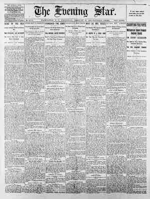
THE EVENING STAR, WEDNESDAY, FEBRUARY 10, 1897-14 PAGES. WASHINGTON'S RAILROAD PROBLEM Full Text of the Commissioners’ Report on the Bill Abolishing Grade Crossings. SATISFACTORY TRACK DEPRESSION HELD TO BE IMPOSSIBLE Five Distinct Plans Considered and Commented Upon at Length. VALUABLE COMPARISONS AND STATISTICS ist. That the intended revision of the railroad company’s line shall be along its present route through the city and to and from the passenger station on B street, ex- cept that the existing Gth street tracks are to be moved west of the street. 2d. That the railroad company shall have a considerably increased area of the mail for terminal purposes, and shall also have for its exclusive use, except, in part, for laying therein public underground ‘con- structions, certain street spaces outside of the space needed for four main tracks. 3d. That the doing away of grade cross- ings be effected by— (a) Depressing the tracks, so that part of the streets at the high ground in Southwest Washington will cross on bridges at grade, or Ya. ave., Canal to 7th eis age 227,890 Va. ave., south side, 2d to 4% (ncluding part of res. 118*). 53,590 Va. fave.. orth side, 4% to 7th #.w. (including parts of reservi . tioas 114° and 1150.. S015 B41 st. west, E to Va. a 11,000, 22,140 ans 7,000 th pw. (including resem 114° and 200"). 30,834 B st., 6th to 7th sx. Reservation 4. Reservation 1 Maryland ave. Maryland Maryland ave., 12th to 14th (in- cluding part of res. 197) 78,980 168,960 1Zth st., 19,360 36, tw E.., Engineers Think the Topography of the City Such as to Make an Elevated Structure Most Advisable. No report from the Commissioners to Congress in recent years has been of more importance than the report submitted to- day upon the McMillan bill, the object of which is to improve the railroad situation in South Washington by abolishing grade crossings. It has been a little over a year now since the original bill was sent to the Commis- sioners for Investigation and report. Realiz- ing the importance of the matter, and with assurances that the Pennsylvania railroad was ready to improve the situation, the Commissioners took up the matter, going | into it with much. thoroughness. District | engineers were detailed to study the situa-| tion. The District surveyors made lines, computed grades and estimated the cost of | the several propositions. As soon as the | tentative plans were worked out, the rail-| road people were called in consultation. | One interview was sufficient to disclose their position. The railroad wanted a de- pressed system, and stated broadly that it Would accept none other. The railroad en-} Sie | lows, The Star presents cuts of the sév- LOCATION OF STATION, COMMISSIONERS Low GRADE PLAN. (b) Closing certain strects, or (c) Raising bridges above present grades. 4th. That the Long bridge be replaced by a new railroad and highway bridge of cer- tain dimensions near the site of the form- Commissioners and the railroad arrived Ste an agreement. It was after this that the Commissioners discussed among themselves what their ac- tion in replying to the McMillan bill should be. The bill {tself was crude in many re- spects and could not be reported; they were unwilling to go on record as favoring an underground system, and had come to the conclusion that an overhead system offered more advantages than any other. One of the first things they did was to decide to recommend the removal of the depot. This involved some intricate problems in grade. Why not change the entire route of the railroad within the city limits? This was the question that presented itself, and then Maj. Powell forthwith. worked out a plan which contemplated the removal of the railroad from Virginia avenue to K street. With an elevated structure along this street, and the depot removed opposite to reservation 113, incoming trains could come in on grade. This finally proved the solution of the question, and this, as will be noted in the report, is the Commissioa- ers’ favorite plan. In connection with the report, which fol- Effect of the Provisions. No mention is made in the bill of rent or taxes on the extra public ground to be granted to the railroad. The company now pays taxes on the part of the mall it uses, and tent for space for side tracks in Canal street. The bill would seem to relieve the company of such payments. In lieu of the closure of Maryland avenue from 12th to 14th streets the company is required to widen D street for thirty feet on its south side from 12th to 14th. The street bridges are to be built by the railroad company; bridge approaches and wing walls and changes of sewers, water mains and street grades, and all damages are to be at the expense of the District. One-half the cost of constructing the new Long bridge and removing the old bridge is to be borne by the railroad company, and one-half by the United States and the Dis- trict. The Commisioners judge that the provi- sions of the bill about the Long bridge are fair and judicious; they suggest that the clear headroom under the bridge should not be decreased below that named in the bili, viz., twenty feet at mean low tide. A limit ing headroom of thirty feet would be desir- able; one of twenty feet, at least, is neces- sary. Partial Depression Not Satisfactory. It is found that the depression of the railroad tracks, as proposed in the bill, and especially as insisted upon by the railroad company, would be, from availa- bility of other and better means of abolish- ing grade crossings, highly unsatisfactory to the public interests, in that it would te expensive to the District, fix a serious and permanent burden upon general street traffic by forcing it to climb over the tracks by high bridges and make detours en account of the closure of streets, and grant to the railroad company very large areas of park and other public spaces in ad- dition to that now occupied by it. The proposed plan of depression, or more properly speaking, low-grade plan, com- prises a full depression at a few streets, a partial depression at others and no depre: sion at some, to say nothing of the closing of several streets. The railroad route lies upon avenues diagonal to the east and West and north and south streets; one can readily understand the interruption to crossing streets made by a sunken road- bed, and that east and west streets would be blocked, if such roadbed were bridged only at some of the north and south streets, and in some of these cases by ele- eral plans, showing in detail the situations. vated structures. In fact, the proposed low-grade plan would not leave any through east and west street in South Washington north of L street; not even hongitudipal 13% st., D to B...... Totals . Credit D st. 1,618,581 (@ Not now occupied by. railroad company.) Grade Crossings Retained. It may be seen from the plate or the tables that there is practically no deprcs- sion of tracks at Delaware avenue, South Capitol street and Ist and 2d streets west by the plan; but that the grade crossings are to be abolished py raising the streets over the tracks or closing the street. Thus, bridges at Delaware avenue, South Capitol street, 2d street west and 4% street would be elevated above the present tracks 19.6 feet, 17.4 feet, 17.1 feet and 11.6 feet, re- spectively, ang} Ist street would be closed; or, in other Words, as to South Capitol street, that every load from the brick works or the asphalt, block and tile works, or elsewhere on the street, would have to be elevated nearly twenty feet for crossing the railroad tracks. The closing of 3d street, as proposed, would be unfortunate. This is a wide street of good grade through from Florida avenue to the arsenal grounds; street rail- roads are on the adjacent and parallel str ets, 2d and 4%. The closing is for con- vealence of the freight station proposed by tue railroad company’s plans to be esiab- lished at and west of 3d street; a bridge here would be long and elevated fifteen feet, but had better be so built than that there should be no bridge here. Virginia Avenue. It may be further noticed that the road- ways of Virginia avenue would pass under the approaches to the bridges over the tracks, and that in such cases, excepting at the very wide spaces at South Capitol street and Delaware avenue, there would be no grade connection between Virginia avenue and the'fridged street. This cir- cumstance, together with the closing of one side of the avenue from 4% to 7th street, and of tHe ‘other side from near 24 to 41% street, would be a most serious de- traction from thé’ usefulness of the ave- nue for general ‘sfreet traffic. Virginia avenueé‘is located to form a thor- oughfare of gréat' convenience; it strikes the Eastern brafich at a natural and suit- able bridge crossing. The proposed high- way extension plans provide for converg- ing streets at thé’sonthern end of an ex- pected bridge at'such location. The bridge and the opening of the avenue would fur- nish a direct route of easy grade from a considerable, papt,pf the country south of the Eastern branch to main points in Washington. Ah’ Inspectfon of the District mapcwill show’ this better’ than any de- scription. : Cost of the Plan, The cost to the District of the foregoing plan of track depression, not counting dain- ages to property by changes of street parts of the Easby's point sewer are com- | tracks, being but little different from the pleted. The other works of the plan of | list of streets to be clered under plan 2 Sewage disposal and protection of the low grounds of Washington against river floods will drain the railroad bed at all times if depressed to about plus 4.9. An Alternative Pia: The plan of low-grade tracks shown on Plate 2, herewith, is drawn for an eleva- tion of rail of plus 4.0 at Delaware avenue, from which the grade rises in either direc- tion within ordinary mits. Before the com- pletion of the new sewers, the railroad company, under this alternative plan of low-grade tracks, would need to pump water falling upon its roadbed or seeping into it at times-of great storms, and the District to reconstruct a small part of the present Tiber sewer. The elevation of rail, plus 4.0, wovld make the raising of the Dalaware avenue bridge 13.6 feet, instead of 19.5 fect; and at 4% street, 6.3 fcet instead of 11.6; the 7th street bridge would cross at present grade instead of being raised 2.6 feet. Other changes in this alternative pian from plan 1 are placing the tracks on the south 55 feet of Virginia avenue instead of in the middle of the avenue, and locating the tracks through the northern parts of squares 434 and 410 south and out of reser- vations 113, 114 and 197. ‘The utility of Vir- ginia avenue would not be as seriously im- paired as in plan 1. For this disposition, however, the railroad company should be required’ to extinguish the right of front- age of a few private properiics on the south side of Virginia avenue. Most of the properties along that side, as can be seen by the smail scale sketch on plate 1 or plate 2, belong to the railroad company or are used for railroad purposes. A Public Reservation in Dange: Reservation 133 is at the intersection cf two lines of vistas, one looking up Mary- jand avenue to the Capitol and the other down Virginia avenue to the Washington monument. It is highly desirable that this reservation should.not be given over per- manently for railroad tracks, but that the grand views from it should’ be preserved and rendered available, and the reservation be made into a park, as inly marked upon the L'Enfant map, and contemplated by the plan of the city approved by Lresi- dent Washington, and followel by improve: ments made since the adopiion of that pian 383 84 Streets Closed in Plan’3. Streets to be closed at crossings of tracks under plan 3: Gth, éast (footbridge); ist, east, fromI tq Canal streets; Half, east, from I to Canal streets; Half, west; Ist, west (footbridge); Sth, west, from D street on scuth side of reservation 113; 13th, west, from D to E streets; 13%, west, from D to E streets; K,.1,-H,-South Capitol to Canai streets; G, South Capitol to Canal streets; F, E, D, at both crossings of track; Mary- land avenue, 12th to 1ith streets;. Canal, from Soutn Capitol to east side of New Jersey venue and partly closed, thence to 2d street, east. Cost and Area Granted. The area of public space to be granted to the raiircad company under plan 3 would be 1,053,072 square feet, and the cost io the District, computed in the same man- ner as for the preceding plans, would be $448,428, ‘The passenger station would be depress- €d, train platforms being about 20.5 feet below the level of the first floor, and the Mall world be freed from ra‘troad occupa- tion. Of the four squares at the depot site, the rsilrcad company owns and occupies one; the erea of the remaining three (one of which is principally used for railroad purrcses) is 125,679 square feet; the as- sessed valuation of the three squares, in- cluding improvements, is $195,354. The area of the four squares is 1 square feet; their assessed valuation is $230,332. Comparison of Pia The three above described plans of de- pressed steam raiiroad tracks may be taken as types of such plans at all practicable at South Washington. Of these, plan 3 ts the best; it would be worthy of careful consideration and per- haps of adoption if some system of depres- sion of tracks is deemed by your commit- tee aksolutely necessary in order to secure the abolition of grade crossings. The mer- its of the plan are comparative, not inher- ent, and further search for a satisfactory solution is desirable. From the topography of South Washing- ton it would appear that a plan combining a viaduct acruss James creck valley and 40s | [f CS. Sw. ——— kind of mn which the railroad com- pany’s reeks to secure. The following table shews the changes of treets by this plan: + 3 Pt s. a= « ez Rate of Grade 3 RE of Street Ap 3 E preaches. Gg £2 i H te zs § < ¢ = as es es = 5 z 2.9 5 zo an} 33.7 es 2 36.1 as s BSG oe . 405 ° 42.3 oss e #00 5 ci 32.7 ~ - 12 3.7 ii Be 3 5 5 5 wth west. 10th west Lith west. _ _ to 6th e. ar62 Results of Fifth Plan, The only streets to be closed, being ones for the depot branch and site, would be Sth street between F and C streets, and D and E streets for 96.5 and 88 feet a west of Sth strect, respecti F, " and I streets would remain open. If the railroad yards, shown near T and th streets, on plate are established, then Sth street between I and K might be closed. The cost to the District for sireet_work, computed as before, would be 3169, the smallest fér any of the plans disc R199 353 STATION AND TRAIN . Main enirance. Restaurant. Agent's private office. . Public waiting space. . Outgoing bas: . Driveways and riage stat SHEDS FOR MARYLAND Ladies’ parlor. ng. TOM, 8. Newsstand. 11. Mail. 14. Incoming baggage. . Parking. at public spaces similarly situated. More- over, there are grave doubts of the ra road company’s right to occupy the reser- vation at all; such was the opinion ex- pressed by the Court of Appeals in a case wherein this question was raised, but not decided. The court stated in its opinion that the question ougnt to be determined judicially upon a proper proceeding. Seme facts in the history of the reservation are now discovered which seem to confirm the court’s opinion. The following tables give the data as to this alternative plan of depressed tracks, called herein pian 2: Plan 2. Grade of bridge Approach north. sout Depression Elevation of rail. of bri Section thre Station Virginia nor Maryland avenue, nor Cana: BALTIMORE AND POTOMAC RAILROAD COMPANY'S PLAN FOR STATION gineers were willing to concede something in the way of grades, but it wanted a di pressed system, and would not even dis- cuss the advantages of an elevated plan. Realizing the importance of mutual agree- ment, and with a full understanding of the railroad’s power to defeat legislation, the Commissioners invited the railroad en- gineers to another conference. This was supplemented by a third, but all to no pur- pose. When the Commissioners discussed depression of tracks, the engineers listened, but when an elevated structure was men- tioned they turned a deaf ear. When the Commissioners were convinced that the railroad could not be won over to a plan of elevation of tracks, they decided to try and improve on the latter's plan. And with only a few minor details of difference the street would be a through highway. Fall Depression Impossible. The topography of South Washington does not admit of a proper plan of depres- sion; on the east is the railroad tunnel, which should be taken as a fixed point, and whose floor is at reference 5 above city datum; west of that is the valley of James creek, whose bottom is about ten feet above datum, and along which and near the surface of the ground the trunk sewers are or must be laid; further on is the high ground to the west of 7th street, and then the important Water street, which is at a low level. The foregoing shows the reasons in gen- eral why the Commissioners feel con- strained to report adversely to the low grade plan of Senate bill 1702. Pe For exhibiting the results from ‘such pro- posed plan of depression more in detail, at- tention is invited to plate, herewith, and to the tables following hereto, showing the railroad company’s plan under the Senate bill and data connected with that plan. Company's Plan. Grade of bridge Approach Depression Elevation Street. of rail. of bridge. north, south. Oth; east... BOT. Oe a 5 b 10; 12.2 12.2 11 10.8 3.0 0.5 (ral oo BREESE zone, Seobaneenee 133 5 g nee . . Water airect 10 be lowered 9 feet’ sod pase’ un- der rallroad viaduct with 12-foot headroom, Depot_branch— Catrect...... 9.9 ae fa Maryland av.. 7.6 85 23 B, south...., 4.1 tee . ‘Train sbed..> (raised 0.4) ox Cloned Streets. Streets to be closed at crossings of tracks by the railroad company’s plan—6th,. east; 2d, east; Ist, east, from north line of I to cans]; Half, east, from north line of I to Half, west; Ist, west; 3d, west, to north line of E street; 8th, west (row closed, being within reservation 113); 13th. % west, D to E; K, I, H From south Capital to canal, G from ‘South Capitol to canal, F, E, D from 4% to Cth, D at lith, C ftom 6th to 7th, B, for 225 feet vest of 6th; Canal, southeast, from South Capitol to éast side of New Jersey avenue, and partly closed; thence to 2d street; E, Virginia avenue, south side, from 2d to 414 Virginia avenue, north side, from 4% to ita; Maryland avenue, from 12th to 14th, Areas Occupied. Areas of streets and reservations now oc- cupied by the Baltimore and Potomac Rail- road Company, and those proposed to be occupied under its plan of depression, in By reference to the report, these plans are readily understood: The Report. Office of the Commisionerr of the District of Columbta, | WASHINGTON, February 9, 1897. Hon. James McMiljan, chairman, > céiimit- tee cn the District of Columbia, gengte. Senator: The Cotamitclatcte "hate the reservation. ‘Present. Proposed honor to submit the, fallowiag report upon | K'stne.--. 2. 48,100 Basso 8. 1102, Fitty-fourth Congress, first : entitled “A bill to providé’ for doing a ‘le oeee ae + +268,056 337,050 with certain srade crossings on the I} sh Ist st. east, I to Canal ( of the Baltimore and Potomac railroad in rt of reservation 258). . ge: 11,220 11,220 the ‘city of Washin, Co- | Ee oe tat reservation. 287). 24,008 lumbla, and for ot! Hoot, South Capitol to Canal” (in- ‘The bill contemplates in the matn: cluding” part of reservation 287) 40,400 srades, neither from changes of gas mains, nor electric wire conduifs, nor conduits cf he Metropolitan and Capital Traction railway companies, is estimated to be $522,- 040. Public space equal to 70 per cent of the area of public space now accupied by the railroad company would be granted in addition to the same. Twenty-three streets wouid be closed for greater or less dis- tances. Eleven streets would have to be bridged above grade and four bridged at grade. The Southern Railway Company owns and occupies squares 209 and 300, lying on either side of E street and west of 12th street. It is probable that under the de- pressed plan of tracks there would be a call for closing E street between 12th and Water streets, and 13tn from Water to E. The closing of these streets is not named in the Senate bill nor shown upon the Balti- more and Potomac Company's plan, and consequently is not listed in the tables above; neither are the changes in streets, resulting from changes in the navy yard and some three or four privaie sidings, which would be required by part depression of main tracks. Such changes would add to the District expense and to the impedi- ments to street traffic. Shallow Depressions. A principal element of the railroad com- Pany’s plan, as outlined above, is the non- depression of its tracks at any place below reference plus 10. Assent to a greater de- pression could not be obtained, the repre- sentative of the company having written to the effect that such decision, by direction of the president of the company, was final. The reasons for retaining the elevation of plus 10 (that of the surface tracks at Dela- ware avenue and Ist street west), are for convenience of ‘éntrance tc the intended, but not yet established, freight station at = | The. Mal SS 7th west Sth west Oh west 10th wer 11th west 13\% west Water street to be lowered § feet and pass under tailroad viaduct with 12-foot_ headroom, DEPOT BRANCH. East. West. © street 14.7 53 1.4 0. Md. ave: 12.3 ce 1.6 0: ‘Train shed... 3.6 ay Streets Closed. Streets to be closed at crossings of tracks, under plan 2—6th, east (foot bridge); 1st, east, from north line of I to Canal; Hz!f, eest, from north line of I to Canal; Half, west; Ist, west (foot bridge); 13th, west, from D to E; 13% west, from D to E; K, I, H, South Capitol to Canal; G, South Cap- itol to Canal; F, E, D at crossing tracks, B, for 44 feet west of 6th street; D at 11th, Maryland avenue from 12th to 14th, Canal, from South Capitol to east side of New Jersey avenue and partly closed; thence io 2d, east; 6th, west, west sidewalk, from C street 1,330 feet northward. Results of This Plan. "The area of public space granted to the railroad company under plan 2 would be 1,279,000 square feet. ‘The cost to the District, estimated in the manner as stated for plan 1, would be $559,151. The increased cost as compared with the cost under plan 1 arises from greater changes of sewers, assuming that rallroad work would be done before the building of the new trunk sewers, and from the additional ccst of four bridge approach- es and the grading of the north roadway cf Virginia avenue at places where, under plan 1, the streets are to be closed. In brief, plan 2 is of little greater cost than plan 1; it is better, however, for gea- eral street traffic, as one can further see by comparing the first and second tables with the fourth and fifth, and plate 1 with PLAN FOR ELEVATED ROAD ON VIRGINIA AND MARYLAND AVENUES. 8a and 4% streets, and for drainage of roadbed. Other suitable locations for a freight sta- tion are available. As to drainage of roadbed, it should be noted that the greatest river freshet known at Washington only reached a height of plus 9 at the arsenzl, and that the eleva- tions of B street north at 6th and 7th streets are only _ 6.25 and plus 6.65, where business Nas been conducted for years at a time without interruptions from floods. The F si part of the Easby’s Point sewer of the sewage disposal plans will intercept a teres, volume of storm water which now fi its way down the slopes and sewers above Pennsylvania avenue and at times of great storms over- flows the B street sewer. The F street sewer is under contract, and the remaining plate 2. But plan 2 is not deemed judicious for the District interests. A Second Alternative Plan. Plate 8, herewith, shows a second alter- native plan of low-grade tracks differing only from plan 2 by the location of a through passenger station at squares 461, 484, 410 and £86, south of reservation 113, and consequently by the omission of the dcpot branch. ‘The fourth table to plan 3, shat toms under’ “Paper Seeman aed aoe depression through the high ground along the existing avenue route would be suitable, but a study does not confirm such opinion. The strect grades are so gentle that pa ing from viaduct to depression would terfere greatly with cross streets. An Elevated System. tem throughout can, however, be applied. Such a system is stcwn upon plate. The passenger sta- tion weuld be a through depot, whose train platform would be elevated about 12.5 feet from the ground floor of the station, The station would be at the same location as the through depressed station of plan 3. ‘The arca of private property to be acquired for the station, including two squares own- ed by the railroad company or principally used fer railroad purposes, is 131,946 square feet, and of an assessed valuation of $15 390.” The viaduct is laid along the south side of Virginia avenue to the passenger station, and thence along the mid of Maryland avenue. The north roadway of Maryland avenue, under this plan, can realily be kept open, and ought to be as the direct approach to the highway part of the Long bridge; in all the depressed plans, Maryland avenue is wholly closed be- tweer. 12th and 14th streets. As for plans 2 and 3, the railroad should be required to extinguish the right of frontage of a few private properties on the scuth side of Virginia avenue. Under this elevated plan the freight sta- tion could be conveniently located on squares 28, 268 and 267, belonging to the railroad company and now used as coal yards, while the latter could be convenient- ly located at the unoccupied railroad prop- erty from near 2d street to 4%. The following tables show results as to streets from plan 4. Elevations and Depressions. PLAN NO, 4. 3 zg ¥ Sen iens = eee 5 Z_ | New grade =o orniet ay Sg OE proach gf Ez a 5 6 to 12th, 5 Md. ave., north side, 12th to 14th..... Water Streets Closed. Streets to be closed at crossings of tracks, under plan 4—6th, east walkway; 8th, west, from D street to street on south side of res. 133; 13th, west, from D street to E 3%, west, from D street to E street; I{], H, South Capitol to Canal streets; G. Scuth Capitol to Canal streets; i. BY D jj, (at both crossings); south side Mary- land avenue, from 12th to 14th streets; Canal, from South Capitol street to east side. of. New Jersey avenue, and partly clcsed, thence to 2d street east. Streets marked thus, ||, closed if a masonry struc- ture is used, but obstructed only if a metal- lic structure is used. The area of public space to be occupied is 1,039,2 square feet. The cost to the District of plan 4, exclusive of damages from chariges of-street grades and of costs of changes of gas mains, would be $288,682, inchiding the purchase of ground for drive- ways at the sides of the station, as indi- cated upon plate 4. .Plan 4 is undoubtedly better for general street traffic than’plan 3 (the best depressed system), The former would furnish a short, direct route through the city and with a maximum of track of 0.76 per cent, the same as leh 1. Another Elevated System. It is proposed to examine one other ele- vated system, believed to be superior to either of the foregoing plans in capacity and convenience, and known herein as AND VIRGINIA AVENUE damages from changes of street grades would also be the smallest. » should be an extra t, however, et work of $88,291, due to this plan, for purchasing a paving the driv sand hack stand at the passenger sta- . and outside of present streets, as ine ted upon the plate Space Gccupicd, The area of public space to be occupied the railroad works, including the I street yard and a Canal street yard of the limits shown on plate 5, is 1.04 square feet. The latter named yard would cicse H street from South Capitol street to Canal street, Ist and Half streets casi, from I to Canal street, and the small reservations, in whole or in part, numbered 27, 288 and {289. It would move the existing tracks from alongside of Garfield Park to the south side of Canzl street: the wall of the elevated yard would be 60 feet noril the south side of the street between Jersey avenue and G street. Canal et illed by ten tracks. The authority 4e5 | lesa a 3t jon and Sheds for the Elevated ute on Water, Sth and K Streets, Main stairway, 7. Tickets, ‘ . Lowby. . Open space (exit to carriages). 0. Outgoing bagyage office. - Outgoing bazzage office. : —— pmasne> mca. : Incoming. jee. \. amit of teal the shed. . Elevation of rail, 31 feet 5 inches. Elevaticn of depot floor, 33 feet. allow space for four tracks. The area of public space within the yard would be 156,- 428 square fect.